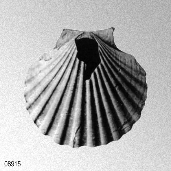
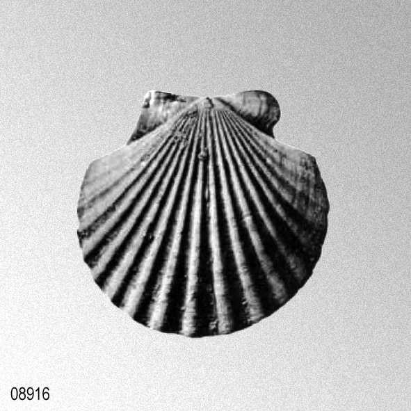
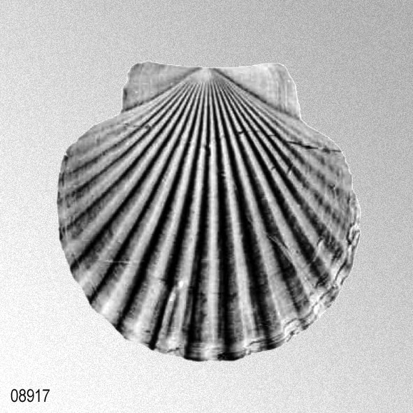
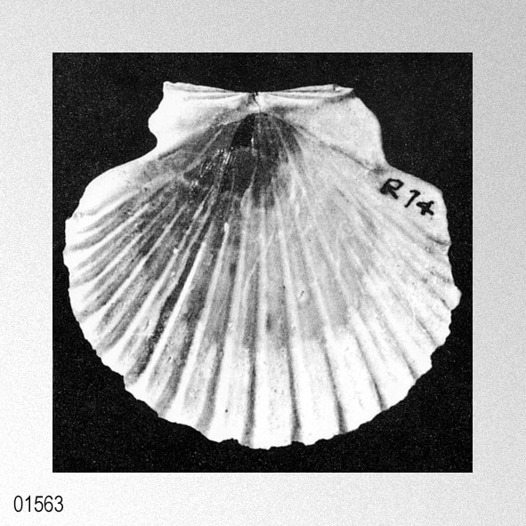
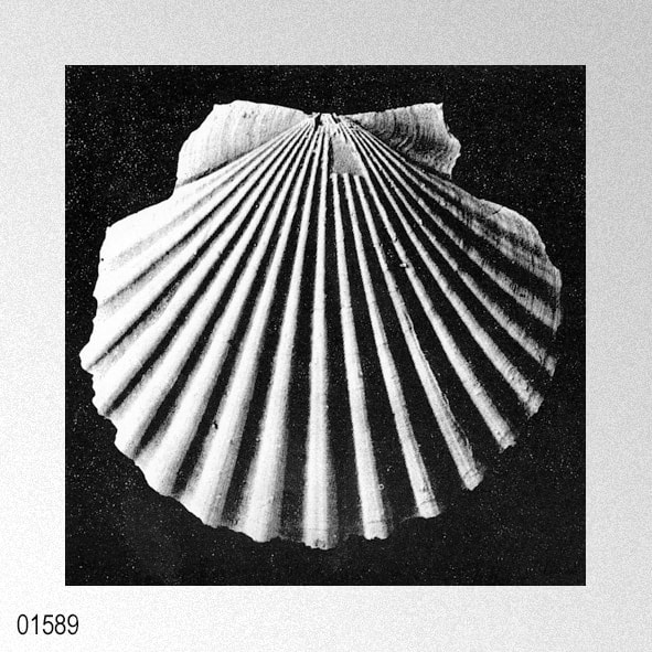
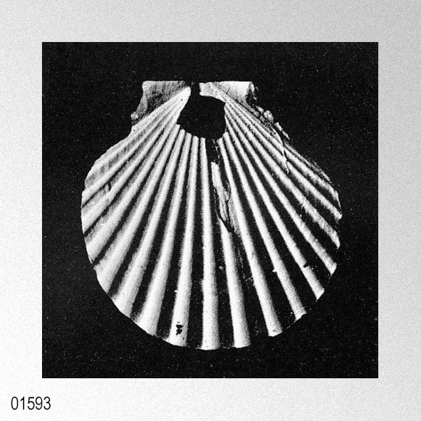
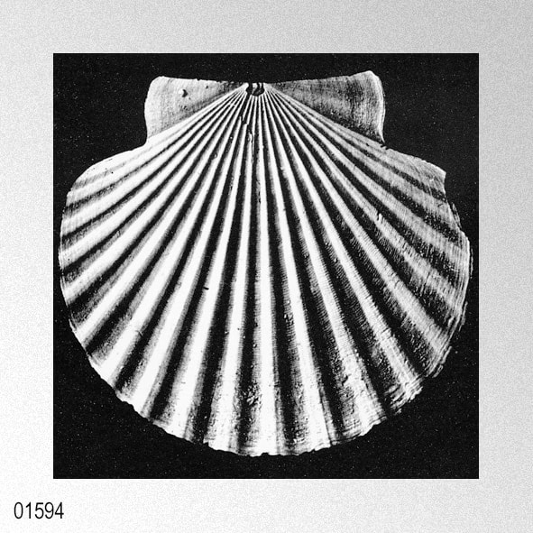
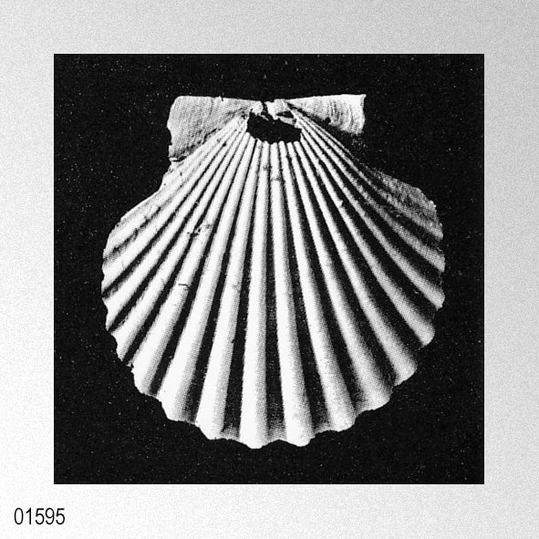
"Pecten" howei howei (Mansfield, 1940)
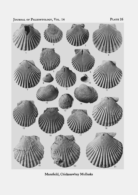
MANSFIELD, W. C. 1940. Mollusks of the Chickasawhay marl. Journal of Paleontology, 14 (3): 171-225, pls. 25, 26. [p. 178, pl. 26, figs. 1, 3, 4]
1940 Chlamys (Plagioctenium) howei Mansfield, 1940
W. C. Mansfield, 1940, plate 26.
|
«Shell small for the group, thin, fragile; the outline between the submargins an arc of not far from 240°; left valve flattened in the umbonal area, very feebly inflated medially; right valve feebly inflated, both in the umbonal area and the medial areas. Prodissoconch retained on many individuals, a minute porcellaneous cuneate shell, smooth except for feeble concentric wrinkles, the beak acute and interrupting the dorsal margin. Primary costals originating at the outer margin of the prodissoconch, not increasing by intercalation; 17 or 18 in number, usually 18, low, rounded, as wide or slightly wider than the intercostals; nonlirate or with feeble, fortuitous threading. Concentric imbrications thin, sharp, very regular overriding the radials, and Iooped backward slightly toward the umbones as they cross the costals, and forward toward the ventral margins at the intercostals. Submargins low, smooth, angular. Auricles rather wide, moderately high; nonlirate except for 1 to 3 fortuitous threads on occasional specimens. Byssal notch shallow; cetenolium absent. Cardinal margins turned inward and a little downward, bevelled, the inner edge acute. Cardinal crura in right valve more strongly developed than those in the left, rudely parallel to the dorsal margin. Ligament pit small, deltoid. Single muscle impression obscure, circular included for the
most part within the upper posterior quadrant. Inner margins crenate in harmony with the primary ribbing. Holotype (U. S. Nat. Mus. 498517, a left valve) measures: Height, 49.0 mm; width, 50.0 mm; convexity, 5.0 mm. Paratype, (U. S, Nat. Mus. 498518, a right valve) measures: Height. 36.4 mm; width, 39,0 mm; convexity, 6.6 mm. Figured specimen (U. S. Nat. Mus. 498519, a right valve) measures: Height., 45.0 mm: width, 47.0 mm; convexity, 9.0 mm. Holotype and paratype from station 14204, lowest bed at bridge over Taylor Mill Creek, on Highway 45, 1½ miles north of Waynesboro, Wayne County, Miss. Figured specimen from station 14286, east of prisoners' house at State Quarry, 3 miles north-northwest of Waynesboro, Wayne County, Miss. Chlamys howei may be known by its compressed, subcircular outline and rather low, smooth ribs overridden by the unusually even, concentric imbrications. The species varies somewhat in the degree of inflation, but the widest range of variation is in the form of the ribs and the occasional development of all obscure secondary liration on the primary costals. Commonly there is a single low thread cresting the rib and giving it an obscurely V-shaped outline, and occasionally near the ventral margin a, secondary is developed on either side of the medial threading, thus squaring the costal. This is particullary noticeable in those specimens in which the intercostals are unusually flat and the angle of intersection with the costals acute. Such variants occur in the same lump with typical C. howei and are not considered to be of taxonomic significance. Chlamys howei is probably related closely to a specimen from the Suwanne limestone of Florida figured by Mansfield, 1937 under the name of Chlamys (Aequipecten) sp. aff. C. vaun wythei Hertlein. a replacement name for Pecten vaughani flabellum Cooke, 1919, from the Miocene of Santa Cruz and Santiago, Cuba. The Cuban shell is smaller than either of the Oligocene forms, the auricles distinct, the dorsal margins more produced and the arc included between thelr extremities not more than 180°. In the Suwannee species the costals are fewer and more prominent than those of C. howei. A form even more closely related to Chlamys howey may be represented in the Flint River formation in Decatur County, Ga., though the specimen in question is incompIete, and the relationship cannot be determined with assurance. The two species are similar in general aspect, but the costals of the Georgia form are more numerous by two or three. Pecten (Aequipecten) effosus Brown and Pilsbry, 1911, from the Gatun formation of the Canal Zone is similar in outline but differs in the somewhat more elevated and angular costals and the lirate auricles. The species has not been recorded in western Mississippi. It is named, in honor of Dr. Henry V. Howe, the head of the Department of Geology at Louisiana State University, Baton Rouge, La. Occurrence.— Lower part of Chickasawhay marl. ALABAMA: Station 10050, 1.7 miles southeast of Gainestown on the road to Lambard's Landing, Alabama River (left valve more sharply sculptured, as a rule, than in the usual C. howey) stations 7163 and 14520, gully north of old road from Jackson to Walker Springs,about 1 mile north of Glendon (left valve more strongly sculptured, as a rule, than in the usual C. hawey) station 7166, east bank of Tombigbee River, just south of Payne' Hammock, bed no. 3, Clarke County; station 13392, 4 miles south of Cullomburg on road to Millry, Choctaw County; station 14291, about 1.3 miles north of Millry (typical), Washington County. MISSISSIPPI: Station 14510, Steep Hill Branch, about one-eighth mile from its mouth, SE ¼ sec. 18, T. 8 N., R. 5 W., from bed four to six feet above limestone ledge; station 14509, Bucatunna Creek, about 200 yard below Steep Hill Branch, bed no. 3; station 10053, 4 miles north of Waynesboro on road to Shubuta, near middle of sec. 24, T. 9 N., R. 7 W., bed no. 4; station 13385, one-eighth mile north of Limestone Church, 1½ miles southeast of Boyce; station 14285, bed above "Chione limestone," Limestone Creek Church locality, 4 miles north of Waynesboro; station 13386, hill above quarry at mouth of Limestone Creek, 3 miles north-northwest of Waynesboro; station 14286, just east of prisoners' house at State quarry, 3 miles north-northwest of Waynesboro; station 14284, cut in first hill north of Limetone Creek, on new highway, 3 miles north of Waynesboro (rare); station 14283a, marl overlying "Chione limestone," top of hill on old road leading down to Limestone Creek, 3 miles north of Waynesboro; station 14282. "Chione limestone," block of limestone along roadside at Limestone Creek, 3 miles north of Waynesboro; station 14204; lowest bed of blue marl, on TayIor Mill Creek, just east of highway bridge on Highway 45, 1½ miles north of Waynesboro; stations 14361, 14362, 14515, glauconitic bed near base of section on Chickasawhay River, about one-fourth mile downstream from bridge on Waynesboro-Laurel road, 2½; miles west of Waynesboro, Wayne County.» WENDELL CLAY MANSFIELD, 1940
|